Discover

You can access the Ohio & Erie Canal Towpath Trail in Cleveland and south of the city from many trailheads.
Towpath trailheads include access to parking as well as signage and other interesting sights. Some trailheads include access to restrooms. Trailheads below are listed north to south.
Check out this full Towpath Trail map for a complete list of trailheads and the mileage between them.
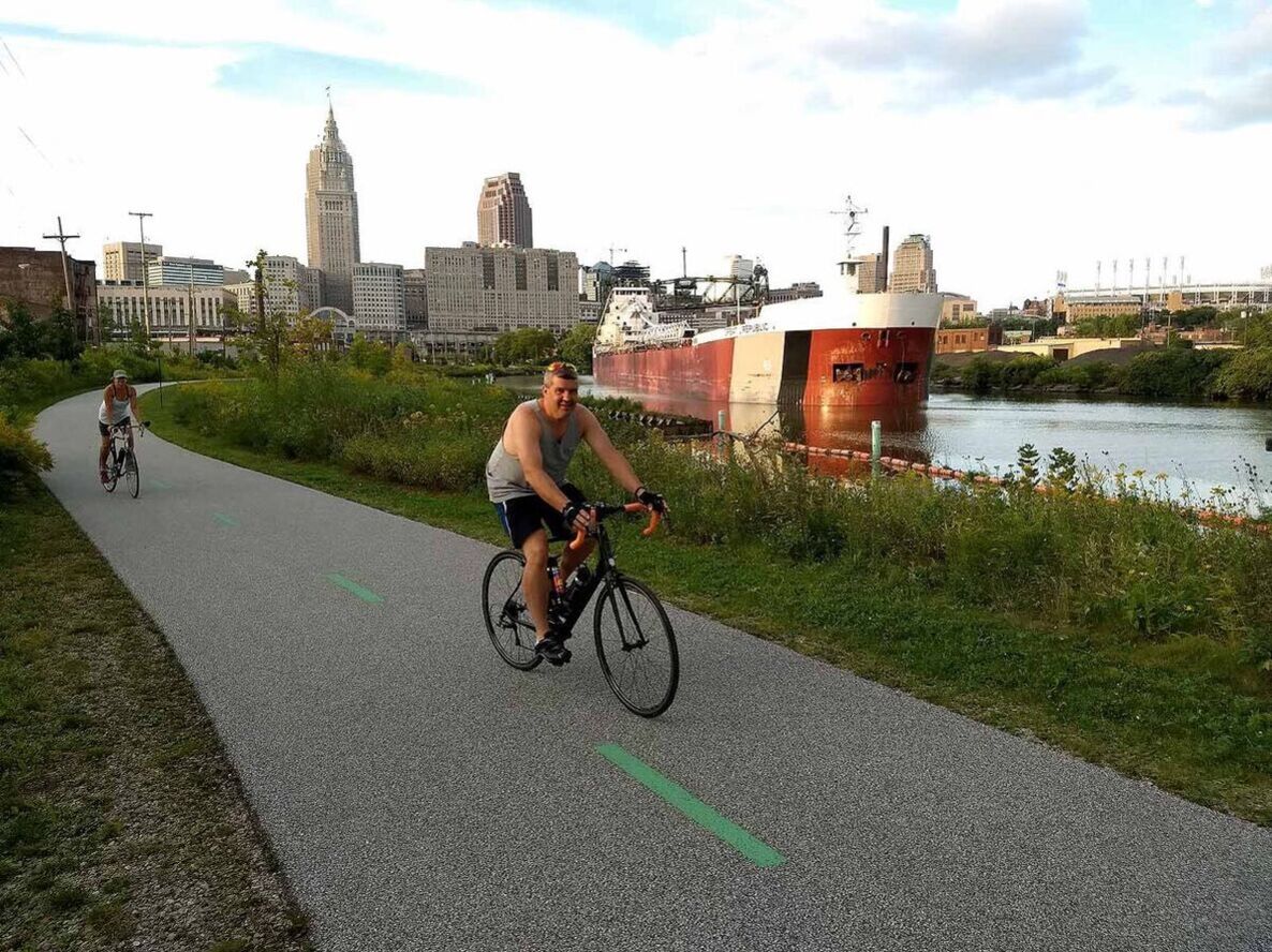
Canal Basin Park is the northern most point of the Towpath Trail. This spot along the Cuyahoga River is where the canal and river met. When the canal was complete in 1832, the canal basin is where Cleveland’s agricultural products were shipped eastward to New York City and where the manufactured items were unloaded for Cleveland consumers.
The trailhead at Canal Basin Park is home to a 70 car parking lot.
Trailhead Address: 989 West St., Cleveland, OH 44113
Previously home to an unused marina and industrial scenery, Scranton Flats is now a natural amenity featuring 9 acres of restored meadowland, a two-acre fish habitat, a large section of restored natural river shoreline, and the Scranton Spoon riverwalk.
The Towpath Trail intersects with the Cleveland Foundation Centennial Trail at this trailhead. There is street parking along Scranton Road.
Trailhead Address: 2057 Scranton Rd, Cleveland, OH 44113
This Overlook at University Avenue and West 13th Street, across the street from the now closed Sokolowski’s University Inn, offers a great view of the Cuyahoga River and the industrial areas that have propelled Cleveland’s growth throughout the city’s history.

Nearby, the Tremont script Cleveland sign is a popular stop for visitors.
Across Abbey Avenue, ample Towpath Trail public parking is available in the lots at 1351 Abbey Avenue and 1429 Abbey Avenue.
Trailhead Address: 1203 University Rd, Cleveland, OH 44113
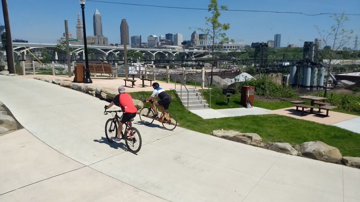
A short walk south from the trailhead at Sokolowski’s Overlook will bring you to Camp Cleveland, the largest of Cleveland’s six Civil War training camps for the Union. The Camp Cleveland Interpretive Area features several oversized swings overlooking downtown Cleveland, a replica Civil War cannon, greenspace with picnic tables and grills, and benches representative of barrack beds beneath a metal framework mimicking the size of the Civil War barracks.
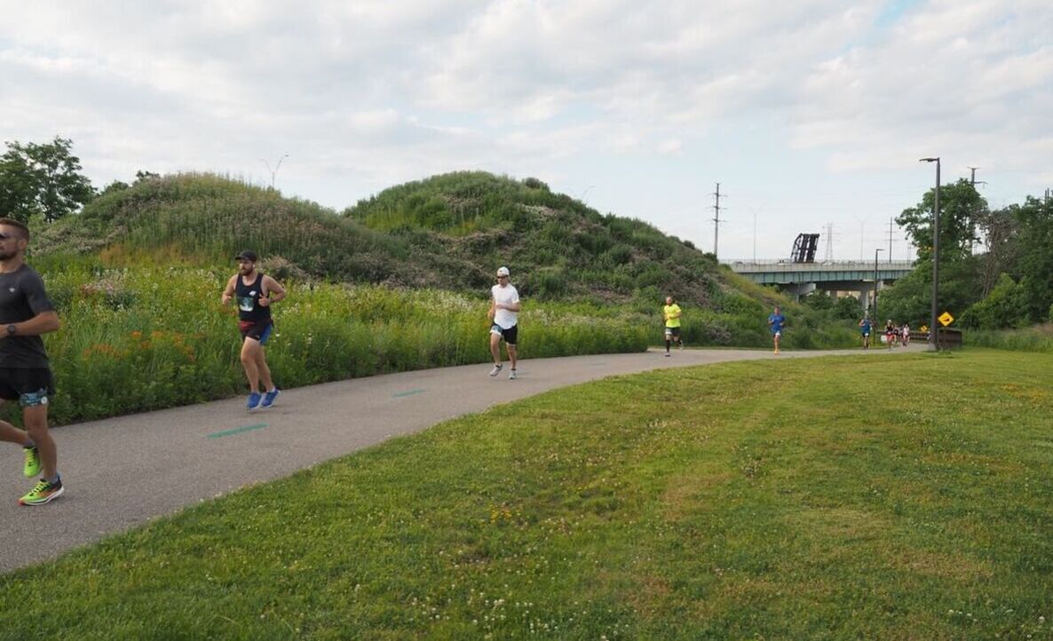
Between W. 7th and Quigley Road, the Towpath Mounds rise to provide a unique perspective. The mounds are designed to be evocative of the bulk storage piles of gravel, sand and iron ore that dot the banks of the Cuyahoga River. Across the trail from the mounds, a cantilevered viewing platform provides an accessible overlook of the industrial valley.
Clark Field is home to parking, a public restroom and a bike repair station. The park is scheduled for a renovation that will include softball/baseball diamonds, football/soccer fields, tennis and basketball courts, an expanded dog park, picnic area, and a playground.
Trailhead Address: 871 Clark Ave, Cleveland, OH 44113
Steelyard Commons is an active shopping center including Target, The Home Depot, Walmart Supercenter, and ALDI, plus restaurants including Five Guys, Burger King, Starbucks and more. It is also home to the Cleveland Cliffs Steel Heritage Center, which celebrates the industrial history of the community.
Parking is abundant in Steelyard Commons.
Trailhead Address: 3447 Steelyard Dr, Cleveland, OH, 44109
Parking spots and a portable restroom are available at this trailhead. Nearby is The Ohio & Erie Canal Reservation, where the trail follows the northernmost remaining 4.4 miles of watered canal and features wildlife management areas, fishing opportunities and scenic beauty.
Trailhead Address: 997 Harvard Ave, Cleveland, OH, 44105
Just a short walk from the Towpath Trail in The Ohio & Erie Canal Reservation is the CanalWay Center, a Cleveland Metroparks nature and visitors center. The center highlights the natural and cultural history of the surrounding area. It features a canal boat play area, a bird viewing room, examples of native and invasive wildlife species, restrooms and a meeting place.
Trailhead Address: 4524 East 49th Street, Cuyahoga Heights, OH 44125
The Trailhead here is located across Canal Road from the Towpath Trail. Bacci Park is also home to pavilions, restrooms, a playground, a fishing pond, ballfields and walking trails, including a connection to the Mill Creek Connector Trail.
Trailhead Address: 5181 Canal Rd, Garfield Heights, OH 44125
This asphalt lot under 480 offers approximately 10 parking spots for visitors.
Trailhead Address: 5650 West Canal Rd, Valley View, OH
Thornburg Station is the historic site of “Zimmerman Tavern”, which in 1830 served canal travelers and quarrymen and was known as a cock- fighting tavern. Today, Thornburg Station is home to Lockkeepers, Yours Truly Restaurant and a Malley’s Chocolate shop.
This trailhead is home to parking and a restroom.
Trailhead Address: 6166 Canal Rd, Valley View, OH, 44125
South of Thornburg Station, the Ohio & Erie Canal Towpath Trail enters Cuyahoga Valley National Park. Learn more about trailheads in the National Park on their website.